
Argyll’s Secret Coast: A 3-Day Cowal Peninsula Itinerary

The Kyles of Bute from the Cowal peninsula

The Cowal peninsula is one of Argyll’s best-kept secrets — a green, watery landscape of sea lochs, forests, gardens and viewpoints barely an hour from Glasgow, yet largely overlooked by visitors racing further north. Its south-western corner is even officially branded “Argyll’s Secret Coast“. This relaxed three-day itinerary reveals the best of Cowal, from oyster bars and giant redwoods to one of the most beautiful views in Scotland.

Where is Cowal and how do you get there?

Cowal is a hand-shaped peninsula between Loch Fyne and Loch Long, in the south of Argyll. You can drive round via Loch Lomond and Loch Fyne (about 1.5–2 hours from Glasgow to Dunoon), or take the quicker and more scenic route by ferry from Gourock to Dunoon across the Clyde. A second short ferry from Colintraive links Cowal to the Isle of Bute, opening up further exploration. The ferries are part of the fun and save long drives.

Day 1: Glasgow to Dunoon via Loch Fyne

Head up past Loch Lomond and round Loch Long and Loch Fyne. Stop at the famous Loch Fyne Oyster Bar at Cairndow for fresh oysters and seafood, then visit the spectacular Benmore Botanic Garden, whose jaw-dropping avenue of giant Californian redwoods leads into a hillside garden of rhododendrons and world plants (an outpost of the Royal Botanic Garden Edinburgh). Continue to Dunoon, Cowal’s Victorian resort town on the Clyde, for the night. Overnight: Dunoon.

Day 2: The Secret Coast & Kyles of Bute

Drive south-west to Tighnabruaich and Kames, the heart of Argyll’s Secret Coast. Pause at the celebrated Kyles of Bute viewpoint on the A8003 — a sweeping vista over the narrow sea channels around the Isle of Bute that ranks among the most beautiful in Scotland. Relax at Portavadie, with its marina, spa and infinity pool looking out over Loch Fyne, and seek out the secluded sands of Ostel Bay (see our best beaches guide). Overnight: Tighnabruaich or Portavadie.

Day 3: Isle of Bute or a slow return

For your final day, take the short ferry from Colintraive to the Isle of Bute and visit the extraordinary Victorian-Gothic Mount Stuart house and its magnificent gardens — one of Britain’s most spectacular stately homes. Alternatively, spend a slower day exploring Cowal’s forest trails, lochside villages and the Argyll Forest Park before returning to Glasgow.

Highlights of Cowal

  • Benmore Botanic Garden — the redwood avenue and hillside gardens.
  • The Kyles of Bute viewpoint — a classic Argyll panorama.
  • Portavadie — marina, spa and infinity pool on Loch Fyne.
  • Loch Fyne Oysters — seafood at the source at Cairndow.
  • Puck’s Glen and the Argyll Forest Park — gorge and forest walks.
  • Ostel Bay — a hidden sandy beach on the Secret Coast.

Where to stay

Dunoon has the widest choice of hotels and guesthouses, while Tighnabruaich and Portavadie offer smaller, scenic options on the Secret Coast. Book Portavadie and Mount Stuart visits ahead in peak season. Cowal’s relative obscurity means it is rarely as busy — or as pricey — as the Highlands.

Tips for visiting Cowal

  • Use the ferries — Gourock–Dunoon and Colintraive–Bute crossings save long drives and are enjoyable in their own right.
  • Allow for single-track roads on the Secret Coast; drive courteously and use passing places.
  • Book ahead for Portavadie’s spa and pool and for Mount Stuart in summer.
  • Pack for changeable weather and midge repellent for still summer evenings.

When to visit

Late spring to early autumn is ideal — Benmore’s rhododendrons peak in May and June, and the long days suit exploring. Autumn brings colour to the forests; winter is quiet and atmospheric. Fit Cowal into a bigger trip with our Scotland itineraries, or pair it with a wider Argyll tour.

History and heritage

Cowal has a long and layered past. Its sea lochs made it a natural domain of the Gaelic clans — notably the Campbells and the Lamonts — and their rivalries left castles and grim tales across the peninsula. In the Victorian and Edwardian eras, Dunoon and the Clyde resorts boomed as Glaswegians came “doon the watter” by paddle steamer for their holidays, and that genteel resort heritage still lingers in Dunoon’s promenade and villas. Today Cowal hosts the famous Cowal Highland Gathering each August, the largest Highland games in the world, a spectacular showcase of piping, dancing and heavy events.

Walking, forests and gardens

Much of Cowal lies within the Argyll Forest Park, part of Loch Lomond and The Trossachs National Park, offering superb walking. Trails range from the gentle fairy-tale gorge of Puck’s Glen to the rugged peaks of the Arrochar Alps just across Loch Long. The mild, wet climate makes this wonderful garden country too, with Benmore Botanic Garden the star — its towering redwoods and hillside plantings are worth the trip alone. Add quiet beaches, lochside cycling and abundant wildlife, and Cowal packs remarkable variety into a small, accessible peninsula.

Why visit Cowal

Cowal’s great appeal is that it delivers classic west-coast Scotland — sea lochs, forests, gardens, big views and a real sense of escape — within easy reach of Glasgow, yet with a fraction of the crowds of the Highlands. Whether as a short break from the city or a peaceful leg of a wider Argyll tour, “Argyll’s Secret Coast” rewards those willing to venture off the beaten track.

This guide is part of our complete Argyll & the Isles travel guide — browse islands, itineraries, distilleries, beaches and castles across the region.

Frequently asked questions

Where is Argyll’s Secret Coast?

It is the south-western corner of the Cowal peninsula, around Tighnabruaich, Kames and Portavadie, in Argyll.

How do you get to Cowal from Glasgow?

By road round Loch Lomond and Loch Fyne (about 1.5–2 hours to Dunoon), or by the quick and scenic ferry from Gourock to Dunoon.

What is there to do on the Cowal peninsula?

Benmore Botanic Garden, the Kyles of Bute viewpoint, Portavadie, Loch Fyne oysters, quiet beaches, forest trails, and a ferry to the Isle of Bute and Mount Stuart.

Is Cowal worth visiting?

Yes — it offers classic Argyll scenery and a genuine sense of escape very close to Glasgow, with far fewer visitors than the Highlands.

Can you visit the Isle of Bute from Cowal?

Yes — a short ferry from Colintraive crosses to Bute, home to the spectacular Mount Stuart house and gardens.

How long do you need for the Cowal peninsula?

Two to three days lets you enjoy Benmore, the Secret Coast and a trip to Bute at a relaxed pace.

Featured image: The Kyles of Bute by John Myers, CC BY-SA 2.0, via Wikimedia Commons.

Whisky Lover’s Islay Itinerary: 3 Days, 8 Distilleries

Bruichladdich Islay Barley Single Malt Whisky

Islay is the promised land for peat lovers — nine working distilleries packed onto one small Hebridean island, producing some of the most characterful whiskies on earth. Three days is the sweet spot for a first whisky trip: long enough to visit eight distilleries at a civilised pace, without turning it into an endurance test. This itinerary groups them by geography to minimise driving and maximise enjoyment, with everything you need to plan the perfect Islay whisky pilgrimage.

Before you go

A little planning makes all the difference on Islay:

  • Book distillery tours well in advance — they sell out, especially around the Fèis Ìle festival in late May.
  • Sort out driving — arrange a designated driver, local taxis or a guided minibus tour so everyone can taste. Drink-driving limits in Scotland are strict.
  • Base yourself centrally in Bowmore or Port Ellen to cut down travel time.
  • Book the ferry early (from Kennacraig) or fly from Glasgow. See our guide to getting to Islay: ferry vs flight.

Compare the distilleries first in our ranked guide to the best Islay distilleries, and for logistics see Islay without a car.

Day 1: The Kildalton coast (3 distilleries)

Start with Islay’s legendary south-shore trio, all within walking distance of each other along the coast east of Port Ellen: Lagavulin, Laphroaig and Ardbeg. Do two full tours (one in the morning, one after lunch) and a tasting at the third, walking between them to clear your palate and enjoy the sea views. Ardbeg’s Old Kiln Café is a great lunch stop. Finish the day at the beautifully carved Kildalton Cross, a little further east — one of Scotland’s finest early-Christian monuments.

Day 2: Bowmore & the west (3 distilleries)

Begin in the island capital with a tour of Bowmore, the oldest distillery on Islay, taking in its famous below-sea-level No.1 Vaults warehouse. In the afternoon head west onto the Rinns peninsula for progressive Bruichladdich — great for understanding terroir, and home to The Botanist gin — and the farm distillery Kilchoman. Round off with a walk on beautiful Machir Bay nearby.

Day 3: The north (2 distilleries, plus more)

Head to the north-east around Port Askaig for Caol Ila, gazing across the Sound of Islay to the Paps of Jura, and gentle, sherried Bunnahabhain at the end of a scenic single-track road. If you still have appetite, the island’s newest distillery, Ardnahoe, is nearby with a superb café and views, and the short ferry to Jura and its distillery leaves from Port Askaig.

That’s eight distilleries

Three south, three central and west, two north — a well-paced eight over three days, with the drams to match. Add Ardnahoe and Jura and you can push it to ten if you have a little longer.

Extending your trip

With a fourth or fifth day you can slow the whole thing down, revisit favourites, take a proper day trip to Jura, explore Islay’s beaches and RSPB bird reserves, or simply enjoy the island’s relaxed pace. A buffer day also protects you against a cancelled ferry. See how long you really need in our Islay itinerary guide.

Where to stay and eat

Bowmore and Port Ellen make the best bases, with hotels, guesthouses and self-catering, plus restaurants and shops. Book early, particularly around Fèis Ìle. Islay also has excellent seafood and produce to enjoy between distilleries.

Tips for the perfect whisky trip

  • Two tours a day is a comfortable maximum; do a tasting or warehouse visit for the third.
  • Warehouse tastings — straight from the cask — are the highlight at several distilleries; book them specially.
  • Bring a driver or use tours and taxis so nobody misses out.
  • Buy distillery exclusives — many bottlings are only available on site.
  • Pace yourself — Islay whiskies are powerful; enjoy, don’t rush.

Understanding Islay whisky

Part of the pleasure of an Islay trip is learning to taste the island’s range. Islay is famous for peat — the smoky, medicinal character that comes from drying the malted barley over peat fires — but the styles vary enormously. The south-shore trio of Lagavulin, Laphroaig and Ardbeg are intensely peaty and maritime; Bowmore and Caol Ila are more balanced; Bruichladdich makes everything from unpeated to the world’s most heavily peated whisky; and Bunnahabhain is largely unpeated and sherried. Doing the distilleries in a thoughtful order lets you appreciate these contrasts rather than blitzing your palate with peat on day one.

Warehouse tastings and festivals

For the keenest whisky lovers, the highlight is often a warehouse tasting — sampling whisky drawn straight from the cask in a dunnage warehouse, often at cask strength. Several distilleries offer these as premium experiences; book them specially. The island’s calendar peaks at Fèis Ìle (the Islay Festival of Music and Malt) in late May, when each distillery has its own open day and releases sought-after festival bottlings — magical, but book everything a year ahead.

Beyond whisky on Islay

Even the most dedicated whisky pilgrim should leave time for the rest of the island. Islay has glorious beaches such as Machir Bay and the Big Strand, superb birdwatching (tens of thousands of geese overwinter here), the historic seat of the Lords of the Isles at Finlaggan, and fine local seafood. Building a rest day or a half-day of sightseeing into your three days makes the trip richer — and gives your palate a welcome pause between drams.

This guide is part of our complete Argyll & the Isles travel guide — browse islands, itineraries, distilleries, beaches and castles across the region.

Frequently asked questions

Can you visit 8 distilleries on Islay in 3 days?

Yes — at roughly two to three per day, grouped by geography, eight distilleries in three days is comfortable with a driver.

Do you need a driver on Islay?

Strongly recommended, so everyone can taste. Use a designated driver, local taxis or a guided minibus tour.

When is the Islay whisky festival?

Fèis Ìle takes place in late May, with special tours and bottlings — book everything far ahead.

Which distilleries are closest together on Islay?

Lagavulin, Laphroaig and Ardbeg on the south (Kildalton) coast are within walking distance of one another.

How do you get to Islay for a whisky trip?

By CalMac ferry from Kennacraig (over two hours) or a 40-minute flight from Glasgow; a car or guided tour helps you reach the distilleries.

Can you visit all nine Islay distilleries in one trip?

Yes with four or five days, but three days comfortably covers eight — leave the rest as a reason to return.

West Coast Scotland Itinerary: 7 Days from Glasgow to the Isles

Oban Bay Scotland

Scotland’s west coast and its islands offer some of the most spectacular scenery in Europe — a world of sea lochs, mountains, white beaches, wildlife and whisky. A week is just enough to sample the best of it. This 7-day West Coast itinerary runs from Glasgow out to the Hebrides and back, as a relaxed self-drive loop that balances big-hitting sights with time to breathe. Adapt it freely to your own pace and interests.

Before you go

This route involves ferries, so book car crossings and island accommodation well ahead, especially in summer. Build in a buffer for weather-related ferry disruption, use a designated driver on distillery days, and expect single-track roads that are slower than the mileage suggests. It can also be done largely by public transport — see Scotland without a car.

Day 1: Glasgow to Oban via Loch Lomond & Inveraray

Leave Glasgow and head north along the bonnie banks of Loch Lomond, then over the dramatic “Rest and be Thankful” pass into Argyll. Stop at Inveraray, with its fairytale castle and historic jail on the shore of Loch Fyne, before continuing to Oban for the night. Overnight: Oban.

Day 2: Oban to the Isle of Mull

Explore Oban — climb to McCaig’s Tower, tour the town-centre distillery, and enjoy the town’s famous seafood. Then take the 45-minute ferry to the Isle of Mull, driving north to colourful Tobermory. Overnight: Mull.

Day 3: Mull, Iona & Staffa

Spend the day exploring Mull’s wildlife — keep an eye out for eagles and otters — and cross from Fionnphort to the sacred Isle of Iona, or take a boat trip to Staffa and Fingal’s Cave. Overnight: Mull.

Day 4: Mull to Islay

Return to the mainland and drive south through Argyll and down the Kintyre peninsula to Kennacraig, for the ferry to Islay, the whisky island (alternatively, fly from Glasgow if you prefer to skip the drive). Overnight: Islay.

Day 5: Islay’s south shore

Tour the peaty legends of the Kildalton coast — Lagavulin, Laphroaig and Ardbeg — walkable together, using our ranking of the best Islay distilleries. Overnight: Islay.

Day 6: Islay’s west & north

Visit Bowmore, Bruichladdich and Kilchoman, and relax on the wild sands of Machir Bay — or take the short ferry to explore wild Jura. Overnight: Islay.

Day 7: Islay back to Glasgow

Ferry back to Kintyre and drive north through Argyll to complete the loop — perhaps pausing on the Kintyre peninsula, at Loch Fyne for oysters, or beside Loch Lomond — before returning to Glasgow.

Where to stay along the route

This itinerary uses Oban (night 1), Mull (nights 2–3) and Islay (nights 4–6) as bases. All three have a good range of hotels, guesthouses and self-catering, but island accommodation is limited and books out early in summer, so reserve as far ahead as you can.

Variations on the route

  • Add Skye: with 10 days, continue north from Oban to Fort William, Glencoe and the Isle of Skye before looping back.
  • Swap Islay for more of Mull: if whisky is not your focus, spend longer on Mull, Iona and the wildlife.
  • Add Kintyre or Gigha: break the return journey with a night on the Kintyre peninsula or a hop to the Isle of Gigha.
  • Slow it down: drop one island and give the others more time — the west coast rewards a gentle pace.

When to go

May, June and September are ideal — long days, better weather and fewer crowds than the July–August peak. Ferries run a fuller timetable in summer; winter is dramatic but many island businesses close and daylight is short. See the best time to visit Scotland for more, and browse our wider Scotland itineraries.

What you will see along the way

This route is a feast of west-coast scenery. Expect brooding sea lochs and the mountains of Argyll, the island crossings with their salt air and seabirds, and the ever-changing Hebridean light that has drawn artists for generations. Wildlife is a constant companion: keep an eye out for eagles over the hills of Mull, otters and seals along the shores, red deer on the moors, and — on boat trips and even from the ferries — dolphins, porpoises and whales. On Islay, the beaches and bird reserves add another dimension entirely.

Budget and practical tips

A west-coast island trip need not break the bank, but a few things are worth budgeting for: ferry fares (cheaper for foot passengers), distillery tours (typically modest, with premium tastings costing more), and island accommodation, which is limited and priced accordingly in summer. Save money by self-catering, using foot-passenger ferries with island buses, and travelling in the shoulder seasons of May, June and September. Fuel is pricier and sparser on the islands, so fill up on the mainland and in the main towns.

Making it your own

The beauty of this loop is its flexibility. Whisky lovers can linger on Islay; wildlife enthusiasts can give Mull more time; and anyone with an extra few days can bolt on Jura, Kintyre and Gigha, or extend north to Glencoe and Skye. Treat the seven-day framework as a starting point, build in slack for the weather and the ferries, and resist the urge to cram in too much — the west coast is best savoured slowly.

This guide is part of our complete Argyll & the Isles travel guide — browse islands, itineraries, distilleries, beaches and castles across the region.

Frequently asked questions

Is a week enough for Scotland’s west coast?

Yes — seven days lets you combine Oban, Mull and Islay with the lochs of Argyll, though you could easily spend longer or add Skye with 10 days.

Do you need a car for this itinerary?

A car gives the most flexibility, but the route can also be done using ferries, coaches and island transport, with guided tours filling the gaps.

Where does the west coast itinerary start?

Glasgow, with its international airport and easy access to Loch Lomond and Argyll.

How many ferries are involved?

Typically two return crossings — Oban to Mull, and Kennacraig to Islay — so book car spaces ahead, especially in summer.

Can you add Skye to this route?

Yes — with 10 days you can extend north from Oban via Fort William and Glencoe to Skye before looping back to Glasgow.

Tiree Travel Guide: Surfing, Sunshine & Getting There

Tiree Gott Bay

Tiree is like nowhere else in Scotland — a low-lying, wind-swept Hebridean island ringed by white shell-sand beaches and turquoise water, and famous for two things above all: sunshine and surf. Lying furthest out into the Atlantic of the Inner Hebrides, it regularly records some of the highest sunshine totals in the whole of Britain, and its reliable wind has made it the country’s watersports capital. Flat, fertile and fringed with dazzling beaches, Tiree is a genuinely special island for anyone who loves the outdoors.

Where is Tiree and how do you get there?

Tiree lies west of Mull, out beyond Coll, at the far edge of the Inner Hebrides. There are two ways to reach it. The CalMac ferry from Oban takes around four hours (calling at Coll on the way), a long but scenic voyage. Far quicker is the roughly 45-minute flight from Glasgow with Loganair — one of the few Scottish islands where flying genuinely makes sense, and ideal for a car-free trip. The island is small and flat, perfect for cycling.

Sunshine and climate

Because Tiree is so flat and treeless, and sits far out in the Atlantic, cloud tends to clear quickly and the island soaks up remarkable amounts of sunshine — it is frequently among the sunniest places in the UK, especially in late spring and early summer. The flip side is the wind, which is near-constant. Together, sun and wind define the island and make it a magnet for watersports.

Surfing and watersports

Tiree’s combination of consistent wind and superb beaches makes it a paradise for surfers, windsurfers, kitesurfers, wing-foilers and paddleboarders. The island hosts the long-running Tiree Wave Classic, one of the world’s oldest professional windsurfing competitions, held each autumn. Balevullin is the classic surf beach, with lessons and board hire available locally for beginners keen to try.

The beaches

Tiree’s beaches are magnificent — the three-mile sweep of Gott Bay, the surf at Balevullin, and a string of white-sand coves and bays around the coast, all backed in summer by flower-rich machair. The water really does turn Caribbean shades of turquoise on a sunny day. Several feature in our guide to the best beaches in Argyll and the Hebrides.

Island culture and history

Tiree has a strong Gaelic crofting culture, with the language still spoken and the traditional way of life very much alive. Look out for the island’s distinctive houses — including “spotty” houses with white-painted mortar between dark stones, and traditional thatched cottages. The heritage centre, An Iodhlann, tells the island’s story, and the annual Tiree Music Festival brings the island to life in summer.

Sights and things to do

  • Watersports — surfing, windsurfing and kitesurfing on the island’s world-class beaches.
  • Cycling — the flat terrain makes Tiree ideal for exploring by bike.
  • Skerryvore lighthouse — the elegant offshore lighthouse, an engineering marvel, with a memorial and viewpoint on the island.
  • The Ringing Stone — a curious glacial boulder that chimes like a bell when struck with a stone.
  • Wildlife and birdwatching — corncrakes, wading birds and seals; the machair is alive with flowers and butterflies in summer.
  • Beach walks and stargazing — with little light pollution, the night skies are superb.

Where to stay

Accommodation includes a hotel, guesthouses, B&Bs and self-catering cottages, plus a hostel and camping. Options are limited, so book well ahead in summer and especially around the Wave Classic and the music festival. Staying several nights lets you make the most of the ferry timetable and the island’s relaxed rhythm.

Best time to visit

Late spring and summer (May–September) offer the best weather, the machair in bloom and the fullest transport timetable; May and June are often the sunniest. Autumn brings the Wave Classic and big surf; winter is wild and windswept, with limited services. Fit Tiree into a wider island-hopping trip with our Scotland itineraries.

History and Gaelic heritage

Tiree has been farmed for millennia — its fertile machair earned it the old name “the land of corn”, and at times it supplied grain across the Hebrides. Prehistoric remains, brochs and early Christian sites dot the island, and it was long part of the domain of the Lords of the Isles before coming under the Dukes of Argyll. Today it retains a strong Gaelic-speaking crofting community, and its distinctive housing — from thatched cottages to the “spotty” and “pudding” houses — reflects generations of adapting to a treeless, windswept landscape. The heritage centre An Iodhlann is the place to delve into this story.

Wildlife and dark skies

Tiree is a haven for wildlife. It is one of the best places in Britain to hear the rasping call of the rare corncrake in early summer, and its shores and lochans teem with wading birds, wildfowl and seals. Whales and dolphins pass offshore, and the flower-rich machair is a summer carpet of colour alive with bees and butterflies. With almost no light pollution, clear nights bring spectacular stargazing — the Milky Way arcs overhead and the aurora is sometimes seen in winter.

Getting around the island

Tiree is small, flat and quiet, which makes cycling the perfect way to get around — you can circle much of the island in a day, wind permitting. There is also a local ring-and-ride bus service, and bike hire is available near the ferry pier and airport. Between the beaches, the wildlife, the watersports and the sheer sense of space and light, Tiree offers a genuinely different island experience — closer to the Outer Hebrides in feel than its Inner Hebridean neighbours.

This guide is part of our complete Argyll & the Isles travel guide — browse islands, itineraries, distilleries, beaches and castles across the region.

Frequently asked questions

Why is Tiree so sunny?

Its flat, treeless landscape and exposed Atlantic position mean cloud clears quickly, giving Tiree some of the highest sunshine totals in Britain, particularly in late spring and early summer.

Is Tiree good for surfing?

Yes — reliable wind and excellent beaches make it Scotland’s premier watersports island, home to the Tiree Wave Classic windsurfing competition.

How do you get to Tiree?

By CalMac ferry from Oban (about four hours, via Coll) or by a roughly 45-minute flight from Glasgow.

Do you need a car on Tiree?

Not necessarily — the island is small and flat, ideal for cycling, and there is a local bus, so a car-free visit works well.

What is there to do on Tiree besides the beach?

Watersports, cycling, birdwatching, the Ringing Stone and Skerryvore lighthouse heritage, Gaelic culture at An Iodhlann, and stargazing.

When is the Tiree Wave Classic?

The windsurfing competition takes place each autumn, typically in October.

Kilmartin Glen: Scotland’s Most Underrated Ancient Site

Neolithic standing stones in Kilmartin Glen, Argyll

Kilmartin Glen, in the heart of Argyll, is one of the most remarkable — and most overlooked — ancient landscapes in Britain. Within a few miles around the little village of Kilmartin lie around 800 prehistoric and historic monuments: standing stones, stone circles, burial cairns, mysterious rock carvings and an ancient royal fortress that was the very cradle of Scotland. Yet it draws a fraction of the visitors of better-known sites like the Callanish stones or Orkney’s Neolithic wonders — which makes exploring it, often alone, all the more magical.

Where is Kilmartin Glen?

Kilmartin Glen lies in Argyll, just north of Lochgilphead and a short drive from the Crinan Canal, on Scotland’s west coast. It is roughly an hour south of Oban and around two hours from Glasgow. The monuments are spread along the glen and across the surrounding hills, so a little planning (and the museum) helps you make sense of what you are seeing.

A landscape of standing stones and cairns

The glen’s centrepiece is a linear cemetery — a line of five great Bronze Age burial cairns running along the valley floor, some of which you can enter to see the stone burial chambers within. Alongside them stand the Nether Largie standing stones and the twin stone circles of Temple Wood, parts of which date back more than 5,000 years. Wandering between them on a quiet day, with the hills all around, gives a powerful sense of deep time.

Prehistoric rock art

Scattered across rock outcrops in the area are enigmatic cup-and-ring marks — prehistoric carvings of concentric circles and hollows whose meaning is still debated by archaeologists. The best-known are at Achnabreck and Cairnbaan nearby, among the finest examples of prehistoric rock art in Britain. Seeking them out adds a real sense of discovery to a visit.

Dunadd: the cradle of Scotland

Rising abruptly from the boggy plain of the Moine Mhor is Dunadd, a rocky hillfort that was the royal capital of Dál Riata, the early medieval kingdom of the Scots who gave their name — and their kings — to Scotland. Near the summit you can still see a carved footprint and basin, thought to have been used in the inauguration ceremonies of its kings, along with an ancient ogham inscription. Climbing Dunadd, and placing your own foot in that 1,300-year-old footprint, is one of the most moving experiences in Scottish history.

Kilmartin Museum

The award-winning Kilmartin Museum, extensively redeveloped and reopened in 2023, is the essential starting point for any visit. It brings the glen’s astonishing archaeology to life with world-class displays, helps you understand and locate the monuments out in the landscape, and has an excellent café and shop. Start here, then head out to explore.

Carnasserie Castle and Crinan

Just up the road stands the atmospheric ruin of Carnasserie Castle, a 16th-century tower house that is free to visit, rarely busy and offers fine views over the glen (see our best castles in Argyll guide). Nearby, the Crinan Canal — “Britain’s most beautiful shortcut” — makes a lovely add-on, with towpath walks and the pretty basin at Crinan.

Why Kilmartin is so underrated

Kilmartin Glen has as much archaeological importance as many world-famous sites, yet because it lies off the main tourist routes and its monuments are spread across the countryside rather than concentrated in one ticketed attraction, it remains gloriously quiet. For anyone interested in history, prehistory or simply atmospheric landscapes, it is one of Scotland’s great hidden gems.

Visiting: practical tips

  • Start at the museum to orient yourself and pick up a map of the monuments.
  • Most outdoor sites are free and open access, reached by short walks.
  • Wear sturdy, waterproof footwear — the ground, especially at Dunadd and the Moine Mhor, can be boggy.
  • Allow at least half a day, ideally a full day, to do it justice.
  • Combine with Carnasserie Castle and Crinan for a rich day out.

Getting there and when to visit

Kilmartin is on the A816 between Lochgilphead and Oban, easily reached by car; bus services run along the route for those without one. Any time of year rewards a visit, though late spring to autumn offers the best weather and the museum and café at full swing. Fit it into a wider Argyll trip with our Scotland itineraries.

Understanding the wider landscape

What makes Kilmartin so special is not any single monument but the sheer density and continuity of them. Over roughly 5,000 years, from Neolithic farmers to the kings of Dál Riata, people chose this glen to bury their dead, mark the land and establish power. Standing at Temple Wood or on the summit of Dunadd, you are looking at layer upon layer of human history in one small, sheltered valley — a rare thing anywhere in Europe. Taking the time to visit several sites in sequence, ideally after a briefing at the museum, turns a series of stones into a genuinely moving story.

Crinan Canal and Knapdale

Just west of Kilmartin, the pretty Crinan Canal cuts across the neck of the Kintyre peninsula, saving boats the long and dangerous voyage round the Mull of Kintyre. A walk along the towpath to the little harbour at Crinan, with its yachts and views out to the isles, makes a lovely, gentle complement to a morning among the standing stones. Nearby Knapdale is famous as the site of Scotland’s first beaver reintroduction — with patience and luck you may spot signs of these industrious animals in the lochs and woods.

Making a day of it

Kilmartin rewards an unhurried visit. Start at the museum, walk the linear cemetery and Temple Wood, seek out the cup-and-ring rock art, and climb Dunadd for the views and that ancient footprint. Add Carnasserie Castle and a stroll along the Crinan Canal, with lunch at the museum café or in Lochgilphead, and you have one of the most rewarding — and least crowded — days out in all of Argyll.

This guide is part of our complete Argyll & the Isles travel guide — browse islands, itineraries, distilleries, beaches and castles across the region.

Frequently asked questions

What is Kilmartin Glen?

An ancient landscape in Argyll containing around 800 prehistoric and historic monuments — standing stones, stone circles, burial cairns, rock art and the Dunadd hillfort — within a few miles.

Why is Kilmartin Glen important?

It holds one of the densest concentrations of prehistoric monuments in Scotland, and Dunadd was the royal capital of Dál Riata, the early kingdom from which Scotland grew.

Is Kilmartin Glen free to visit?

Most of the outdoor monuments are free, open-access sites; the excellent Kilmartin Museum charges admission.

Where is Kilmartin Glen?

Just north of Lochgilphead in Argyll, on the A816 about an hour south of Oban.

How long do you need at Kilmartin Glen?

At least half a day, ideally a full day, to visit the museum and explore the main monuments and Dunadd.

Can you climb Dunadd?

Yes — a short but sometimes boggy walk leads to the summit, where you can see the ancient carved footprint and superb views over the glen.

Featured image: standing stones, Kilmartin Glen by diego_cue, CC BY-SA 3.0, via Wikimedia Commons.

Isle of Colonsay: Scotland’s Quietest Island Escape

Kiloran Bay beach on the Isle of Colonsay

The Isle of Colonsay is one of Scotland’s quietest and most captivating island escapes — a tiny, remote Hebridean gem lying between Mull, Islay and Jura, home to fewer than 150 people, a world-class beach, a lush subtropical garden and a surprising wealth of good food and drink. If you truly want to switch off, slow down and feel like you have the Hebrides to yourself, Colonsay is the island for you.

Where is Colonsay and how do you get there?

Colonsay sits out in the Atlantic, west of the Kintyre peninsula and north of Islay. It is reached by CalMac ferry from Oban, a journey of around 2 hours 15 minutes, with a separate summer service also linking it to Islay and Kintyre. Crucially, ferries run only on certain days of the week, so you must plan your visit carefully around the timetable — this is part of what keeps Colonsay so wonderfully quiet. There is also a small airstrip with occasional flights. The island is small enough to explore by bike or on foot, making a car-free trip easy.

Kiloran Bay and the beaches

Colonsay’s crowning glory is Kiloran Bay, regularly rated among the most beautiful beaches in Scotland — a wide, golden crescent backed by dunes and green hills, with turquoise water and rarely another soul in sight. It alone justifies the journey. Beyond it lie more quiet coves and sands, and the island’s compact size means you can beach-hop with ease. See our guide to the best beaches in Argyll and the Hebrides.

Colonsay House Gardens

Sheltered by the island’s mild climate, the Colonsay House Gardens are a delight — woodland gardens famous for their rhododendrons and exotic plantings, with the formal walled garden and a seasonal café. It is a peaceful place to wander and a reminder of how the Gulf Stream allows tender plants to thrive this far north and west.

Oronsay and its priory

At low tide you can walk across the tidal sands (the “Strand”) to the neighbouring island of Oronsay, home to the atmospheric ruins of a 14th-century Augustinian priory with beautifully carved stones and a sense of deep peace. It is one of Colonsay’s most rewarding excursions — but check the tide times carefully, as the crossing is only safe for a few hours around low water.

Wildlife and nature

Colonsay’s varied habitats — machair, moorland, woodland and shore — make it a haven for wildlife. It is excellent for birdwatching, with choughs, corncrakes and seabirds, and its waters host seals, otters and, in summer, basking sharks and dolphins. The island’s flower-rich machair is spectacular in early summer.

Food, drink and island life

For such a small island, Colonsay is remarkably well provided. It has its own brewery and a craft gin distillery (Wild Thyme Spirits), prized local oysters and wild honey from native black bees. The island hotel is the social hub with a bar and restaurant, and there is a bookshop and seasonal café. Colonsay even hosts a well-regarded book festival and other small events that draw visitors back year after year.

Things to do

  • Relax on Kiloran Bay and the island’s other beaches.
  • Walk or cycle the quiet roads and coastal paths.
  • Cross to Oronsay at low tide to see the priory.
  • Visit the gardens, brewery and gin distillery.
  • Watch wildlife and simply enjoy the peace.

Where to stay

Accommodation is limited to the island hotel, a scattering of self-catering cottages and B&Bs, and a backpackers’ lodge, so book well ahead — especially as ferry days concentrate arrivals. Staying two or three nights suits the ferry timetable and lets you truly unwind.

Day trip or longer?

Because ferries run only on certain days, a same-day return is difficult for most of the week, so Colonsay is best enjoyed as an overnight or multi-night escape rather than a day trip. That is no bad thing — this is an island that rewards slowing right down.

Best time to visit

Late spring and summer (May–September) bring the best weather, the machair in bloom, the fullest ferry timetable and the island’s events. Autumn and winter are very quiet, with limited services but a stark, peaceful beauty. Combine Colonsay with a wider tour using our Scotland itineraries.

History and heritage

Colonsay and its tidal neighbour Oronsay have been inhabited since prehistoric times, with ancient shell middens, standing stones and duns dotted across the islands. Oronsay’s ruined 14th-century priory, with its beautifully carved grave slabs and cross, is one of the finest medieval monastic sites in the Hebrides. Like much of the west coast, the islands passed through Norse and then Gaelic clan control, and the small population today farms, crofts and increasingly welcomes visitors seeking peace and nature.

Walking, cycling and golf

Colonsay is made for gentle exploration on foot or by bike. Quiet single-track roads and coastal paths lead to hidden beaches, viewpoints and the gardens, and the island’s modest size means nowhere is far. There is even a rugged 18-hole links golf course laid out over the machair — one of the most natural and characterful courses in Scotland. Walkers can climb the island’s modest hills for wide views over the surrounding isles, and beachcombers will find the shell-strewn strands endlessly rewarding.

The appeal of true remoteness

What sets Colonsay apart is its sheer tranquillity. With ferries only on certain days, no crowds, dark skies and a strong sense of community, it offers a rare chance to properly disconnect. Bring a book (or visit during the book festival), settle into the rhythm of the tides and the ferry timetable, and let the island’s slow magic work on you. It is the antidote to a hectic Highlands road trip.

This guide is part of our complete Argyll & the Isles travel guide — browse islands, itineraries, distilleries, beaches and castles across the region.

Frequently asked questions

How do you get to Colonsay?

By CalMac ferry from Oban (about 2 hours 15 minutes), with a summer link to Islay and Kintyre. Ferries run only on certain days.

What is Colonsay known for?

Its stunning Kiloran Bay beach, tranquillity, Colonsay House Gardens, tidal Oronsay with its priory, and local produce including beer, gin, oysters and honey.

Can you do Colonsay as a day trip?

The ferry timetable makes day trips difficult on most days; Colonsay is best enjoyed as an overnight or longer escape.

Can you walk to Oronsay?

Yes — at low tide you can cross the sands to Oronsay and its ruined priory, but always check the tide times before setting out.

Do you need a car on Colonsay?

No — the island is small, so cycling or walking works well, and many visitors travel as foot passengers.

Is there anywhere to eat on Colonsay?

Yes — the island hotel has a bar and restaurant, there is a seasonal café, and the island produces its own beer, gin, oysters and honey.

Featured image: Kiloran Bay by M J Richardson, CC BY-SA 2.0, via Wikimedia Commons.

Kintyre Peninsula Road Trip: The Kintyre 66 Route Explained

Mull of Kintyre lighthouse, Kintyre peninsula

The Kintyre 66 is Argyll’s answer to the North Coast 500 — a roughly 100-mile touring route around the long, beautiful Kintyre peninsula in Scotland’s south-west. Quieter, gentler and far less crowded than its Highland cousin, it packs in whisky, wild Atlantic beaches, pretty harbour villages, ancient sites and one very famous headland, all within easy reach of Glasgow. This guide explains the route, its highlights and how to plan the perfect Kintyre road trip.

What is the Kintyre 66?

The Kintyre 66 is a signed, self-drive touring route that loops around the Kintyre peninsula, taking in both the rugged east coast and the surf-washed west, with Campbeltown at its southern tip. Launched to spread visitors beyond the honeypots of the Highlands, it delivers classic west-coast Scotland — sea lochs, single-track roads, distilleries and empty beaches — without the summer crush. It is best driven over two or three unhurried days.

Where to start: Tarbert

Most people begin at Tarbert, the pretty fishing village that guards the narrow neck of Kintyre where it joins Knapdale. With its horseshoe harbour, ruined castle above the town, seafood restaurants and lively festivals, Tarbert is a lovely place to start (or end) the loop and a natural overnight base.

The east coast: Skipness, Carradale and Saddell

Heading south down the quieter east side, you pass Skipness, with its peaceful seaside castle ruin and a renowned seafood shack, and the village of Carradale, with its harbour, forest walks and sandy bay. Don’t miss Saddell Bay, where an Antony Gormley cast-iron figure gazes out to sea near the ruins of Saddell Abbey — one of the most atmospheric spots on the whole route.

Campbeltown: the whisky capital

At the southern end sits Campbeltown, once known as “the whisky capital of the world” with more than thirty distilleries. Today three remain — Springbank, Glen Scotia and Glengyle — making it a compact and rewarding stop for whisky lovers; see our guide to Campbeltown whisky. The town also offers a picture house, a museum, and boat trips to Davaar Island, where a cave holds a Victorian painting of the Crucifixion revealed at low tide.

Machrihanish and the Mull of Kintyre

On the wild west side near Campbeltown, Machrihanish boasts a world-class links golf course and a vast Atlantic surf beach backed by dunes. Further south lies the dramatic Mull of Kintyre, the headland immortalised by Paul McCartney (who has a farm on the peninsula), with a lighthouse, a steep walk and views across the sea to Northern Ireland, just 12 miles away. Near the southern tip, Southend and Keil are home to “St Columba’s Footprints”, carved into the rock.

The west coast back to Tarbert

Driving north up the west coast, you follow long, empty Atlantic beaches such as Westport (popular with surfers) and reach Tayinloan, where the ferry crosses to the lovely Isle of Gigha — an easy and highly recommended add-on. From here the A83 runs back up to Tarbert along the shores of the sea, completing the loop.

Beaches and islands

Kintyre has some of Argyll’s finest and least-crowded beaches, from Westport and Machrihanish on the Atlantic side to quiet coves on the east. Add the short hop to Gigha and you can combine the road trip with genuine island time. See our guide to the best beaches in Argyll and the Hebrides.

How long do you need?

You could drive the loop in a long day, but that would miss the point. Two to three days lets you enjoy the whisky, the beaches, Gigha and the villages at Kintyre’s relaxed pace. Three days is ideal if you want to add the Mull of Kintyre walk and a night on Gigha.

Where to stay

Tarbert and Campbeltown are the main bases, with hotels, guesthouses and self-catering; smaller options dot the coast at Carradale, Machrihanish and beyond. Book ahead in summer, as accommodation on the peninsula is limited.

Getting there and practical tips

  • From Glasgow, Tarbert is roughly three hours’ drive down the shores of Loch Lomond and Loch Fyne on the A82/A83.
  • By public transport, Scottish Citylink coaches serve Tarbert and Campbeltown, and there is a small airport at Campbeltown with flights from Glasgow — so a car-free trip is possible.
  • Fill up on fuel in Tarbert or Campbeltown; petrol stations are sparse elsewhere.
  • Allow for single-track roads on the quieter east coast and use passing places courteously.

A little history of Kintyre

Kintyre has been a crossroads of Gaelic and Norse cultures for over a thousand years. Legend holds that the Norse king Magnus Barelegs was granted any island he could sail around, and had his men drag his longship across the narrow isthmus at Tarbert so he could claim the whole peninsula. Later it became heartland of the powerful Clan Donald, Lords of the Isles, and Campbeltown grew into a wealthy town on the back of herring fishing and its many distilleries. That layered history is written into the peninsula’s castles, chapels and standing stones.

Wildlife and nature

The long, quiet coastline of Kintyre is superb for wildlife. Golden and white-tailed eagles soar over the hills, otters and seals patrol the shores, and the waters of the Atlantic and the Kilbrannan Sound are rich in porpoises, dolphins and basking sharks. Boat trips from Campbeltown and Carradale offer the chance to see them, while the beaches and machair are alive with birds and wildflowers in summer.

Events and local produce

Kintyre has a lively calendar for such a rural corner, including the Tarbert Seafood Festival, the Campbeltown Malts Festival celebrating its whiskies, and the Mull of Kintyre Music Festival. Local produce is a highlight throughout — fresh seafood from Tarbert and Carradale, Kintyre cheese and beef, and of course the whisky of Campbeltown. Slow down, eat well and enjoy the peninsula’s unhurried, friendly pace.

This guide is part of our complete Argyll & the Isles travel guide — browse islands, itineraries, distilleries, beaches and castles across the region.

Frequently asked questions

What is the Kintyre 66?

A roughly 100-mile scenic touring route around the Kintyre peninsula in Argyll, styled as a smaller, gentler alternative to the North Coast 500.

How long does the Kintyre 66 take?

Two to three days is ideal to enjoy the whisky, beaches, villages and the Isle of Gigha without rushing.

What is there to see on Kintyre?

Tarbert, the Saddell Gormley statue, Campbeltown’s distilleries, Machrihanish beach and golf, the Mull of Kintyre, and the ferry to Gigha.

How far is Kintyre from Glasgow?

Tarbert is roughly three hours’ drive from Glasgow, down the side of Loch Lomond and Loch Fyne.

Can you do the Kintyre 66 without a car?

It is easiest by car, but coaches serve Tarbert and Campbeltown and there are flights to Campbeltown, so a car-free version is possible with planning.

Featured image: Mull of Kintyre lighthouse by Alan Reid, CC BY-SA 2.0, via Wikimedia Commons.

Isle of Gigha Travel Guide: Beaches, Achamore Gardens & Where to Stay

The coast of the Isle of Gigha, Argyll

The Isle of Gigha (pronounced “gee-a”, with a hard g) is one of Scotland’s most charming and least-visited islands — a green, fertile sliver off the west coast of Kintyre, famous for white-sand beaches, a spectacular subtropical garden, superb local produce and a genuine, hard-won community spirit. Just seven miles long and home to around 160 people, Gigha packs an astonishing amount into a small space, and its mild Gulf Stream climate earns it the nickname “God’s Island”. Whether you come for a day or stay a few nights, it is one of the most restful escapes in the Hebrides.

Where is Gigha and how do you get there?

Gigha lies just off the west coast of the Kintyre peninsula in Argyll. Reaching it is refreshingly simple: a short (around 20-minute) CalMac ferry crosses from Tayinloan, on the A83 about halfway down Kintyre, to the island’s main village of Ardminish. Tayinloan is roughly a three-hour drive from Glasgow down the shores of Loch Lomond and Loch Fyne. Foot passengers and cars are both carried, and because the island is so small and flat, many visitors leave the car on the mainland and explore on foot or by bike.

Achamore Gardens

Gigha’s crowning glory is Achamore Gardens, a 54-acre woodland garden begun in 1944 by Sir James Horlick (of the malted-drink family), who chose Gigha precisely for its frost-free climate. Sheltered from the Atlantic winds and warmed by the Gulf Stream, the gardens are world-renowned for their rhododendrons and azaleas — a riot of colour in late spring — alongside exotic and subtropical plants that would never survive on the mainland. Woodland walks, a walled garden and viewpoints make it a place to linger for hours; it is now owned and cared for by the island community.

Gigha’s beaches

For such a small island, Gigha has gorgeous sands. The standout is the Twin Beaches at An Tairbeart, a double-sided sandbar with white sand and turquoise water on both sides — a genuinely magical spot, and one of our picks of the best beaches in Argyll and the Hebrides. Beyond it, a string of quiet coves and bays offer perfect places for a swim, a picnic or simply a barefoot wander with barely another soul in sight.

A community-owned island

Gigha’s story is a remarkable one. In 2002, after generations under private landlords, the islanders raised the funds to buy the island themselves through the Isle of Gigha Heritage Trust — one of Scotland’s landmark community buyouts. The result is an island run by and for its residents, with a palpable sense of pride and renewal: new housing, restored gardens, and even community-owned wind turbines (the “Dancing Ladies”) that help fund the island. That spirit is part of what makes visiting Gigha special.

Things to do on Gigha

  • Walk or cycle the island — Gigha is small, flat and quiet, ideal for exploring at a gentle pace; bike hire is available.
  • Play golf — the island’s charming nine-hole course has sea views from almost every hole.
  • Watch wildlife — otters, seals, porpoises and a rich birdlife, with basking sharks sometimes seen offshore in summer.
  • Explore the history — the ruins of St Cathan’s chapel, an ancient Ogham-inscribed standing stone, and the old crofting landscape.
  • Simply switch off — Gigha is a place for slow days, sea air and quiet beaches.

Food and drink

Gigha punches above its weight for local produce. The island is known for its farmed Gigha halibut, island-made cheese and ice cream, and wild honey from native black bees. The social hub is The Boathouse at Ardminish, a lovely café-restaurant serving fresh local seafood by the shore, while the island hotel offers meals and a warm welcome. Stock up in the village shop if you are self-catering.

Where to stay

For an overnight stay — and Gigha is lovely once the day-trippers have left — there is the island hotel, a handful of self-catering cottages and B&Bs, and a small campsite. Options are limited, so book well ahead in summer. Staying over lets you enjoy the beaches and gardens in the soft evening light and the wonderful island quiet after dark.

Day trip or overnight?

The short ferry and the island’s small size make Gigha an easy and rewarding day trip from Kintyre — you can see Achamore Gardens and the Twin Beaches comfortably in a few hours. But if you have the time, an overnight transforms it from a quick visit into a proper escape, with the island almost to yourself.

Best time to visit

Late spring (May–June) is arguably the finest time, with the Achamore rhododendrons in full bloom and long, mild days. Summer is lovely for the beaches (bring midge repellent for still evenings), while autumn and winter are quiet and atmospheric. Combine Gigha with a Kintyre road trip or a wider tour of Argyll and the isles.

A short history of Gigha

Gigha has been inhabited for thousands of years, and its rich soils and sheltered position made it a prize long fought over. Its Norse name reflects the era of Viking control of the Hebrides, and the island later passed through the hands of Clan MacNeill and a succession of other owners. Reminders of that long past are scattered across the island: the ruins of the 13th-century St Cathan’s chapel at Kilchattan, an ancient Ogham-inscribed standing stone, and the old crofting townships. The story reached a turning point in 2002 with the community buyout, which secured the island’s future in the hands of the people who live there.

Wildlife and the outdoors

Gigha’s varied coastline and mild climate support a wonderful range of wildlife. Otters and seals are regularly seen around the shore, porpoises and dolphins pass offshore, and in summer basking sharks — the world’s second-largest fish — are sometimes spotted in the surrounding waters. The island is excellent for birdwatching, with seabirds, waders and birds of prey, while the machair and hedgerows come alive with wildflowers and butterflies in early summer. Gentle walking and cycling routes make it easy to explore all of this at a slow, restorative pace.

Golf, food and slow days

Gigha’s charming nine-hole golf course has sea views from almost every tee and welcomes visitors — an unusually scenic round. Between rounds, walks and beach visits, the island’s food is a real pleasure: fresh seafood and local produce at The Boathouse, island-made cheese and ice cream, and honey from native black bees. Ultimately, though, the greatest thing to do on Gigha is very little at all — this is an island made for slow mornings, long beach walks and watching the light change over the Sound of Gigha.

This guide is part of our complete Argyll & the Isles travel guide — browse islands, itineraries, distilleries, beaches and castles across the region.

Frequently asked questions

How do you get to the Isle of Gigha?

By a roughly 20-minute CalMac ferry from Tayinloan on the Kintyre peninsula; foot passengers and cars are both carried.

What is Gigha known for?

Achamore Gardens, its white-sand Twin Beaches, its mild climate, its local produce, and its status as a community-owned island.

Can you visit Gigha as a day trip?

Yes — the short ferry and the island’s small size make it an easy day trip, though an overnight stay is lovely.

How do you pronounce Gigha?

“Gee-a”, with a hard g.

Do you need a car on Gigha?

No — the island is small and flat, ideal for exploring on foot or by bike, so many visitors travel as foot passengers.

When is the best time to visit Gigha?

Late spring for the rhododendrons at Achamore Gardens, or summer for the beaches; the island is quiet and mild year-round.

Featured image: Isle of Gigha by Stuart Wilding, CC BY-SA 2.0, via Wikimedia Commons.

Kilchurn Castle: How to Get the Famous Photo (Parking & Viewpoints)

Argyll Scotland

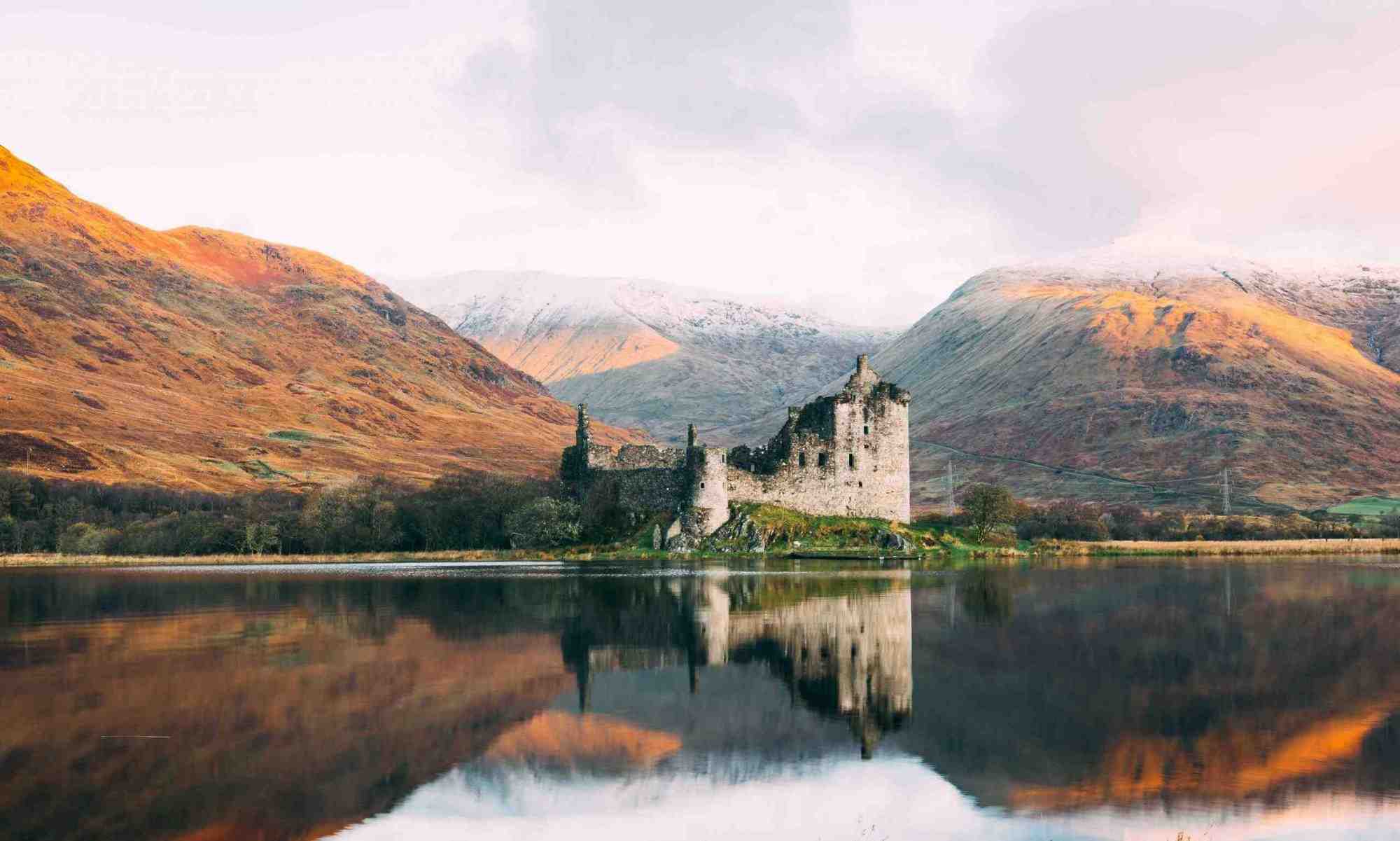
Kilchurn Castle on Loch Awe is one of the most photographed ruins in Scotland — a 15th-century Campbell stronghold set on a promontory, ringed by water and framed by the peaks of Ben Cruachan. It is the classic Highland castle shot. But getting the photograph, and reaching the castle itself, trips up a lot of visitors, because the best viewpoint and the castle are in two different places. This guide covers exactly how to do both, plus the best light, parking and access.

A little background

Kilchurn was built around 1450 by the Campbells of Glenorchy and expanded over the following two centuries into an imposing lochside fortress, before being abandoned in the 18th century after being damaged by lightning. Today it is a free, open ruin cared for by Historic Environment Scotland, and its dramatic setting at the head of Loch Awe makes it a photographer’s dream in any season.

Getting the famous photo

Here is the key thing most people don’t realise: the classic image — the castle with Loch Awe and the mountains behind — is not taken from the castle itself. It is shot from an elevated viewpoint on the hillside above the A85, near the junction with the A819 at the head of Loch Awe. From up there you look down on the castle sitting on its promontory, with the loch stretching into the distance — the postcard composition. There is a rough layby on the A85 close by; park carefully, and take care crossing the road and climbing the bank, which can be muddy and slippery.

For a different angle, the shoreline near the castle gives lovely reflections, and (where permitted and flown responsibly) the scene is spectacular from the air. Whatever your kit, a wide-angle lens captures the sweep of castle, loch and mountains best.

Visiting the castle itself

To reach the ruin, park in the small signposted car park off the A85 just north-east of the Loch Awe village turn-off. From there it is a flat walk of about 10–15 minutes across a field and (often boggy) ground to the castle — wear waterproof footwear, especially after rain. The castle is free to enter as an open HES site; the tower interior and its viewing platform are usually open in the summer season, giving views back up the loch.

Best time and light

  • Early morning is magical, with mist rising off the loch and soft light on the mountains — and you will often have the viewpoint to yourself.
  • Sunset can light the castle and hills beautifully from the west.
  • Autumn adds golden and russet colour to the surrounding hills.
  • Calm days give mirror-like reflections of the castle in the loch.
  • After rain, dramatic skies and clearing cloud make for moody, atmospheric shots.

Getting there — including by train

Kilchurn sits at the head of Loch Awe in Argyll, roughly 20 minutes east of Oban by car on the A85, and about 1.5 to 2 hours from Glasgow. Remarkably, the Loch Awe railway station on the scenic Oban line is within walking distance of the castle, so you can visit by train from Oban or Glasgow — a rare car-free castle (see our guide to Scotland without a car). In summer, boat trips on Loch Awe also pass the castle.

Combine it with

Kilchurn pairs well with a wider Argyll trip — Oban and its islands to the west, Inveraray and Loch Fyne to the south, and the dramatic Pass of Brander and Ben Cruachan close by. It tops our list of the best castles in Argyll and features among the best castles in Scotland.

Tips

  • Wear waterproof boots for the boggy walk to the castle.
  • Take care at the roadside viewpoint — the layby is small and the A85 is fast.
  • Go early for the best light and fewest people.
  • Check the tower’s seasonal opening if you want to go inside.

This guide is part of our complete Argyll & the Isles travel guide — browse islands, itineraries, distilleries, beaches and castles across the region.

Frequently asked questions

Where is the best viewpoint for Kilchurn Castle?

The elevated hillside above the A85 near its junction with the A819, which gives the classic view of the castle with Loch Awe and the mountains behind.

Can you walk to Kilchurn Castle?

Yes — it is a flat 10–15 minute walk from the car park off the A85, across ground that is often boggy, so wear suitable footwear.

Is Kilchurn Castle free to visit?

Yes — it is a free, open Historic Environment Scotland site; the tower interior opens seasonally.

Can you get to Kilchurn Castle by train?

Yes — Loch Awe station on the scenic Oban line is within walking distance of the castle.

When is the best time to photograph Kilchurn Castle?

Early morning for mist and soft light, or autumn for colour; calm days give the best reflections in the loch.

Best Castles in Argyll: Which of the 61 Are Actually Worth Visiting?

Loch Awe

Argyll is sometimes called Scotland’s castle county, with around sixty castles and fortified ruins scattered across its mainland and islands — a legacy of its position as the historic heartland of the Gaelic-speaking Scots and the mighty Lords of the Isles. You certainly cannot visit them all, and many are inaccessible ruins on private land. These are the ones genuinely worth your time, with a few honest words on which to skip.

The must-visit castles

Kilchurn Castle

The romantic ruin of Kilchurn Castle on Loch Awe is Argyll’s most photographed castle, sitting on a spit of land and framed by water and mountains. A stronghold of the Campbells of Glenorchy, it is free to visit and utterly atmospheric — the classic view from the hillside above the A85 is one of Scotland’s great photo opportunities. See our dedicated Kilchurn photo guide for parking and viewpoints.

Inveraray Castle

The fairytale, turreted Inveraray Castle is the grand seat of the Duke of Argyll, chief of Clan Campbell, on the shores of Loch Fyne. With its conical towers, opulent interiors, armoury hall and fine gardens — and a starring role in a Downton Abbey Christmas special — it is the most rewarding Argyll castle to tour inside. The nearby Inveraray Jail makes an excellent companion visit.

Castle Stalker

The impossibly picturesque Castle Stalker sits on a tiny tidal islet in Loch Laich near Appin — a perfect little tower house familiar from Monty Python and the Holy Grail. It is best admired and photographed from the roadside viewpoint; interior visits are by limited, pre-booked guided tour only.

Duart Castle, Mull

Guarding the Sound of Mull from its clifftop, Duart Castle is the dramatic ancestral stronghold of Clan Maclean, restored in the 20th century and still lived in by the family. It is a highlight of the Isle of Mull and offers wonderful views.

Dunstaffnage Castle

A mighty 13th-century fortress on a rocky promontory near Oban, Dunstaffnage has links to Robert the Bruce and once held Flora MacDonald prisoner. Cared for by Historic Environment Scotland, it is easy to reach and rewarding to explore, with a ruined chapel in the woods nearby.

Worth a look if you’re nearby

Dunollie Castle and Museum, on the hill above Oban, combines a ruined MacDougall stronghold with a good little museum and fine views. The atmospheric ruin of Carnasserie Castle near Kilmartin is free, rarely busy and pairs perfectly with a visit to Kilmartin Glen. Further south, peaceful Skipness Castle on Kintyre is a little-visited seaside ruin, and on Islay the island in Loch Finlaggan holds the remains of the seat of the Lords of the Isles.

A little history

Argyll’s castles tell the story of the powerful clans — Campbell, MacDonald, Maclean and MacDougall — who fought for control of Scotland’s western seaboard for centuries. Many began as the strongholds of the Lords of the Isles, the semi-independent Gaelic rulers of the Hebrides, before the Campbells rose to dominance. That turbulent past is written into every ruin.

Which to skip

Be realistic: many of Argyll’s “castles” are fragmentary ruins, on private land, or simply not set up for visitors. Unless you are a dedicated castle-bagger, focus on the handful above rather than chasing every dot on the map. For the country’s finest fortresses overall, see our guide to the best castles in Scotland.

Practical tips

  • Check opening seasons — several Argyll castles (Inveraray, Duart) close in winter.
  • Book Castle Stalker ahead if you want to go inside; otherwise enjoy the viewpoint.
  • Combine nearby sites — Kilchurn with Loch Awe, Carnasserie with Kilmartin, Dunstaffnage and Dunollie with Oban.
  • Wear sturdy footwear for the free open ruins, which can be muddy.

This guide is part of our complete Argyll & the Isles travel guide — browse islands, itineraries, distilleries, beaches and castles across the region.

Frequently asked questions

How many castles are in Argyll?

Around sixty castles and fortified ruins, though only a handful are genuinely set up for visitors.

What is the most famous castle in Argyll?

Kilchurn Castle on Loch Awe is the most photographed, while Inveraray Castle is the grandest to tour inside.

Which Argyll castle can you go inside?

Inveraray Castle, Duart Castle on Mull and Dunstaffnage near Oban all have visitor access; Kilchurn and Carnasserie are free open ruins.

Is Castle Stalker open to visitors?

Only by limited pre-booked guided tours; most people photograph it from the roadside viewpoint near Appin.

Which castle was in Monty Python and the Holy Grail?

Castle Stalker featured as “Castle Aaargh” in the film.

Twitter